-
Uncertainty could influence demand and supply of the crops, resulting in price volatility and inaccurate shortage anticipation
-
Monitoring crop progress remotely is important in risk estimation and management
-
Harvest progress could be tracked and the spatial distribution of crop production could be assessed
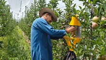
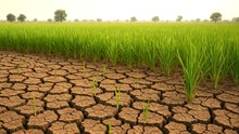
Agriculture is a risky business. Crop yields are exposed to a multitude of perils, relating to production, weather, crop prices, credit availability, and policy decisions; and to mitigate these risks Crop Insurance becomes imperative. However, arguably the most crucial feature of crop insurance is getting the claim on time and injustice.
But here's the good news! Specialized technology - satellites, remote-sensing data, unmanned aerial vehicles, and artificial intelligence - can now be used to assess crop yield estimates, and thus reduce delays in crop insurance claim settlements all while saving precious time and resources. These high-tech agricultural technological tools now bring reliable field analytics to farmers, traders, and insurers!
Let’s take a look at what crop monitoring assisted by technology can offer in practice:
Accurate field area measurement
Measuring a field by physically walking around its boundaries lacks precision - is time-consuming and inconvenient. In contrast, satellite imagery can calculate the actual area of a field in a matter of seconds. As a result, insurance can be a claimed basis for real and accurate numbers. Satellite images, which are in the red and infrared spectral range, can also help the farmer get an opportunity to observe fields on a real-time basis.
Assess, predict field productivity
Crop Monitoring using technology can assess both the current and potential productivity of a field. Accurate data on soil fertility can be collected using the 'zoning; feature in satellite imagery. Not only does it provide the true natural color but also measures the Normalized Difference Vegetation Index (NDVI) in the near-infrared - or the vegetation density. Using this feature, the true state of the crops can be determined and the total area of productive segments within a field can be easily calculated.
Assess crop productivity
Crop rotation history is a convenient way to get data on the state of the soil. Add to that historical weather and NDVI-based zoning, this tech feature enables a complete analysis of the field’s productivity. Farmers, traders, insurers can make sure the crop type matches the soil as picking the wrong crop for a specific soil may lead to soil infertility, erosion, and pests infestation in the future. Historical data on the NDVI is used to analyze the vegetation growth trends, analyze the climate impact on crops, and on the field’s productivity. It can even anticipate weather risks and foresee yields.
And here’s the bonus!
-
Rational fertilizing may be enhanced by satellite pictures.
-
Labour prices may be reduced as fewer individuals are going to be needed to observe an over-sized piece of land.
-
Near absolute accuracy may be achieved with data knowledge.
-
Data may be collected and archived for future reference and analysis.


Share your comments