The Tropospheric Emissions Monitoring of Pollution (TEMPO) sensor will let scientists to track air pollutants and their sources from space in more detail than ever before, down to the neighbourhood level. According to Kevin Daugherty, NASA's TEMPO project manager, the device will assess pollution and air quality on an hourly basis across wider North America during the day, "from Puerto Rico up to the tar sands of Canada."
The information will be used by the US Environmental Protection Agency (EPA), the National Oceanic and Atmospheric Administration (NOAA), and other agencies tasked with combating air pollution.
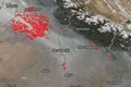
"The TEMPO mission is about improving life on Earth for all," NASA Administrator Bill Nelson said in a statement. "NASA data will help improve air quality across North America and protect our planet by monitoring the effects of everything from rush-hour traffic to pollution from forest fires and volcanoes," he added.
TEMPO, which is about the size of a washing machine and has been described as a space chemistry laboratory, will be hosted on an Intelsat communications satellite in geostationary orbit. Because existing pollution-monitoring satellites are in low Earth orbit, they can only give measurements once a day at a predetermined time. TEMPO will be able to measure atmospheric pollution down to the neighbourhood level, or 4 square miles (10 square km).
"Geostationary orbit is a common orbit for weather satellites and communications satellites," Caroline Nowlan, an atmospheric physicist at the Harvard & Smithsonian Center for Astrophysics, told news agency AFP. TEMPO will be in a geostationary orbit 22,236 miles (35,786 km) above the equator, matching the rotation of the Earth, which means it will always be over North America.
"The great thing about TEMPO is that for the first time, we'll be able to make hourly measurements over North America, so we'll be able to see what's going on for the rest of the day as long as the sun is up," Nowlan added. TEMPO will be used for a variety of purposes, including assessing the levels of various pollutants, forecasting air quality, and assisting in the formulation of emission-control measures.
According to the American Lung Association, more than 40% of the US population, or 137 million people, live in areas with harmful levels of particle pollution or ozone. Air pollution is responsible for approximately 60,000 premature deaths per year.
TEMPO will monitor pollutants such as nitrogen dioxide, which is created by the combustion of fossil fuels, formaldehyde, and ozone. The data will be made available online so that members of the public can monitor air quality in their neighbourhood. Daugherty stated that TEMPO will be operational by the end of May or early June and will begin producing data in October, though it will not be accessible to the public until April of following year.