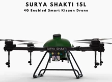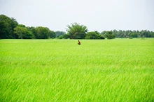
The Government has lifted the bans on drones in the interest of agriculture mapping and satellites are also helpful in predicting weather. Drones assists in mapping the loss in the crop due to the heavy rain or other natural disastrous actions.
In view of crop insurance and towards settling of the claim, the drones are very much helpful in gazing the loss of the crop. By the introduction of these new era technologies the face of the agriculture has also changed.
In February 2019, the Canadian Space Agency (CSA) is going to up its game by launching 3 identical synthetic aperture radar Earth observation satellites. The 3-satellite configuration will provide as many as four daily revisits of Canada’s entire land mass. With this satellite array in place (it’s known as the “RADARSAT Constellation,”) the CSA will gather data for maritime surveillance, disaster relief, climate change and ecosystem monitoring, and of course, agricultural monitoring.
Steve Shirtliffe of the University of Saskatchewan focused on how drones can be used to assess crop health. Shirtliffe also pointed out the advantages of remote sensing. Similar to the satellites, the drones are equipped with special sensing equipment to analyze crops at a distance, but that’s where the similarity ends. A drone can’t cover the vast distances that a satellite can, but it can provide more detailed information for smaller samples.

Satellites can’t compete with drones when it comes to examining the productivity of single plants or plant stands. That use requires much closer inspection than satellites can attain. Remote sensing with drones is ideal for field testing and is becoming an essential tool for plant breeders and agronomists, Shirtliffe said.
One of the discussions at last month’s Joint Conference of the Canadian Wheat Symposium and the Canadian Workshop on Fusarium Head Blight explored how remote sensing is opening up possibilities for monitoring soil conditions and crop health.
Heather McNairn, a research scientist with Agriculture and Agri-Food Canada’s Ottawa Research and Development Centre, looked at the role satellites have begun to play in agricultural research.
McNairn pointed out the difficulties in the “boots on the ground” approach to monitoring of the growth cycle of plants and how it is cumbersome and inefficient. She made the point that at 158.7 million acres of total farmland in Canada (93.4 million in crops), boots on the ground can’t reach every acre. But satellites, orbiting at 800 km above the Earth and travelling at more than 25,000 km/h can cover much more ground, much more quickly.
McNairn explained that the satellites collect measurements of the amount of energy emitted, reflected or scattered. The intensity of energy depends on the type and condition of soils and crops. For instance, in the visible light spectrum, the amount and wavelength of light reflected can provide information on plant pigmentation, internal leaf structure and moisture. Whereas, in the microwave spectrum (which is unaffected by cloud cover) a deeper penetration can be attained than would be possible in the visible spectrum. Microwave sensors are sensitive to moisture in the soil and in the canopy, and can also reveal information about the canopy structure and can be used to estimate biomass.

Canada is a world leader in the type of satellite technology used for this purpose. Known as synthetic aperture radars (SARs), Canada got into the game back in 2004, and continues to stay ahead of the curve.
Some of the imaging equipment that Shirtliffe’s team has been working with includes an RGB camera to record visible light; a multi-spectral camera that isolates five specific wavelengths in the visible spectrum as well as the near infrared; and a thermal camera to measure heat signatures.
They also use sonar sensing equipment. With these instruments they are able to gather data that, once processed, can offer useful insights for agronomists. Some of the case studies that Shirtliffe referenced included herbicide tolerance in fababeans, lentils and PPO inhibitors, and canola phenotyping. The process is also used for head counting and estimating biomass and canopy volume.
For Shirtliffe, this is just the beginning. “We are gearing up with a new lab and new facilities to do this on a big scale and we are looking forward to working with plant readers and agronomists as we move ahead.”


